- 觀光專區Sightseeing area
- 鄰近觀光景點Nearby tourist attractions
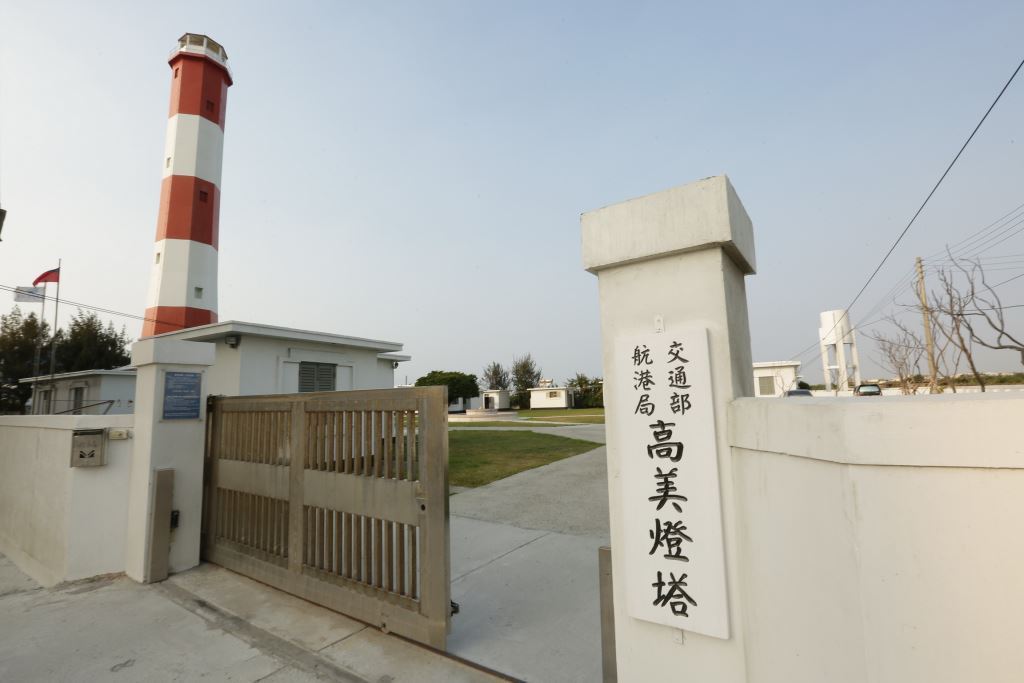
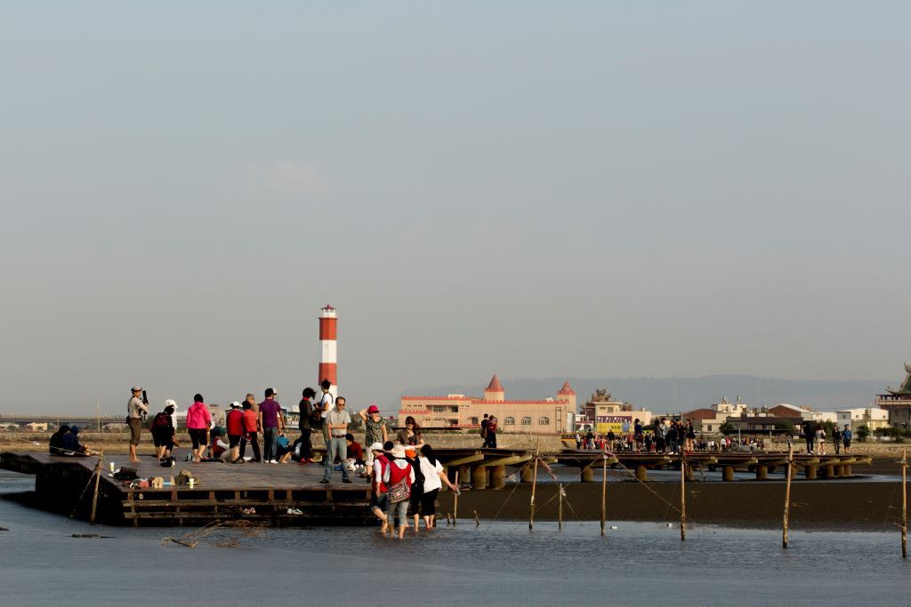
- 高美濕地Gaomei Wetland
高美濕地Gaomei Wetland
高美濕地(高美野生動物保護區)的前身為高美海水浴場,從日治時期開始,海水浴場一直是遊客夏日的休閒勝地,隨著臺中港的啟用,高美海水浴場泥沙日漸淤積,導致遊客漸漸稀少,在不得已的情況下,只好宣告關閉,卻也因為泥沙的堆積,造就了今天生態豐富的高美濕地。
Gaomei Wetlands (Gaomei Wildlife Sanctuary) was formerly known as Gaomei Beach. Since the Japanese colonial period, the beach has been a summer leisure resort for tourists. With the opening of Taichung Port, Gaomei Beach has become increasingly silt and sandy. Due to siltation, the number of tourists gradually became scarce. As a last resort, the wetland had to be closed. However, due to the accumulation of sediment, today's ecologically rich Gaomei Wetland was created.
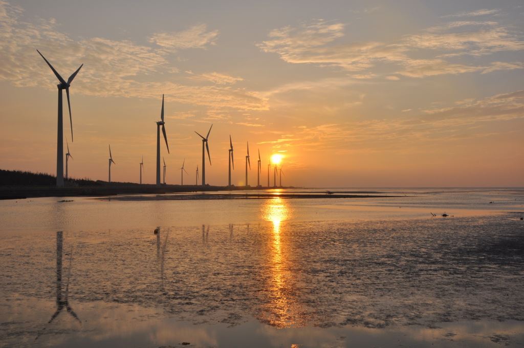
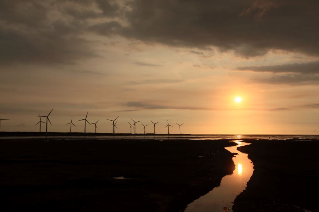
高美濕地雖然面積不大,但是由於泥質及沙質灘地兼具,加上與河口沼澤地帶鑲嵌在一起,所以孕育了豐富又複雜的濕地生態,以及目前所知全臺灣最大族群的雲林莞草區,形成乾濕相間伴有植物生長的複雜地形,因為地形多變,生態種類亦相當複雜,主要種類為鳥類、魚類、蟹類及其他無脊椎類等生物;每年秋冬之際,都會有大批的候鳥前往作客,不管是短暫的休息,或是駐足過冬,都為高美濕地增添了不同的生態風貌,更成為賞鳥人士的新據點,許多民眾坐在木棧道休憩賞夕陽
Although the Gaomei Wetland is small in area, it has both muddy and sandy beaches, and is embedded with the estuary swamp area, so it has nurtured a rich and complex wetland ecology, as well as the largest known ethnic group of cloud forests in Taiwan. The Guancao District forms a complex terrain with alternating dry and wet conditions accompanied by plant growth. Because the terrain is changeable, the ecological species are also quite complex. The main species are birds, fish, crabs and other invertebrates; every autumn and winter , there will be a large number of migratory birds visiting, whether for a short rest or staying for the winter, adding a different ecological style to the Gaomei Wetland, and becoming a new base for bird watchers. Many people sit on the wooden boardwalk to relax and watch the sunset.
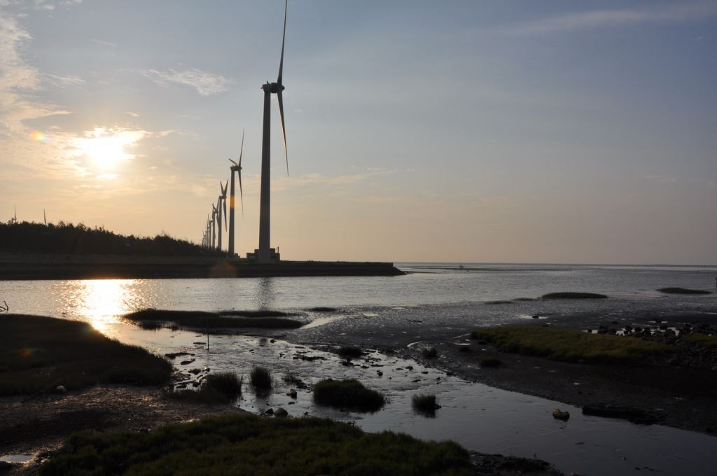
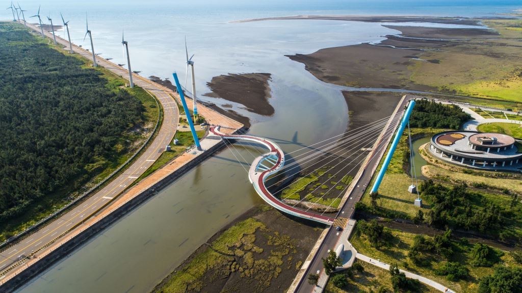
高美自行車道是沿著清水大排、海堤至高美溼地,南起濱海橋、北至高美海堤防汛道路,全長3.3公里,車道旁緊鄰清水大排和高美溼地,除了可以鳥瞰整片高美溼地外,同時也是賞鳥、看夕陽的好地方,未來還可眺望西側海岸正在興建的風力發電機組,是個可以讓遊客旅遊休憩的好地方。
The Gaomei Bike Trail runs along Qingshui Dapai and the seawall to Gaomei Wetland. It starts from Binhai Bridge in the south and ends at Gaomei Seawall Flood Control Road in the north. It is 3.3 kilometers long. The lane is adjacent to Qingshui Dapai and Gaomei Wetland. In addition to offering a bird's-eye view of the entire Outside the Gaomei Wetland, it is also a good place for bird watching and watching the sunset. In the future, you can also overlook the wind turbines being built on the west coast. It is a good place for tourists to travel and rest.
高美地區位居於清水區的最西北之區域,緊鄰大甲溪與台灣海峽,高美古早叫做「高密」,因為這一地區的海灘深度能將撐船的竹竿整支吞沒下去,而在台語發音上,高與竹竿的竿發音同,密則有淹沒的意思,故稱高密。 「高美」一名為日治時期所改的稱呼,高美地區範圍包括今日的高美、高東、高西、高南及高北等五里,早在漢人未入高美地區屯墾,此地大部份是大甲溪的河床地,至今我們仍可從高美地區農民以石頭為材料就地堆築田埂,便可略窺一二。
The Gaomei area is located in the northwestmost area of Qingshui District, close to the Dajia River and the Taiwan Strait. Gaomei has long been called "Gaomi" because the beach depth in this area can swallow the entire bamboo pole of a boat. In Taiwanese pronunciation, Gao has the same pronunciation as bamboo pole, while Mi means drowning, so it is called Gao Mi. The name "Gaomei" was changed during the Japanese occupation. The Gaomei area included today's Gaomei, Gaodong, Gaoxi, Gaonan and Gaobei. As early as before the Han people settled in the Gaomei area, Most of this land is the river bed of Dajia River. We can still get a glimpse of it from the farmers in Gaomei area who used stones as materials to build field ridges on the spot.
一直以來此處為台中觀賞夕陽的最佳首選,風車伴隨著日落西沉的美景深深吸引不少攝影愛好者。生態豐富,更是親子遊憩的好去處。近年整治規畫後,更適宜悠遊漫步賞美景!
This has always been the best place to watch the sunset in Taichung. The beautiful scenery of the windmills as the sun sets in the west has deeply attracted many photography enthusiasts. It is rich in ecology and is a good place for parents and children to relax. After renovation and planning in recent years, it is more suitable for leisurely strolling and enjoying the beautiful scenery!
資料來源:台中市觀光旅遊網Source: Taichung City Tourism Network
https://travel.taichung.gov.tw/zh-tw/Attractions/Intro/54/%E9%AB%98%E7%BE%8E%E6%BF%95%E5%9C%B0-%E9%AB%98%E7%BE%8E%E9%87%8E%E7%94%9F%E5%8B%95%E7%89%A9%E4%BF%9D%E8%AD%B7%E5%8D%80